Ymele:DC locator map with state names w usmap.png
Nænig mare micelness nis brucendlicu.
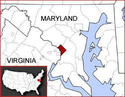
DC_locator_map_with_state_names_w_usmap.png (252 × 196 pixela, ymelan micelness: 46 KB, MIME cynn: image/png)

|
This locator map image could be re-created using vector graphics as an SVG file. This has several advantages; see Commons:Media for cleanup for more information. If an SVG form of this image is available, please upload it and afterwards replace this template with
{{vector version available|new image name}}.
It is recommended to name the SVG file “DC locator map with state names w usmap.svg”—then the template Vector version available (or Vva) does not need the new image name parameter. |
Map created by Kmf164-maps (with the same name) in the English Wikipedia, under the cc-by-sa-2.5 licence.
This file is licensed under the Creative Commons Attribution-Share Alike 2.5 Generic license.
- Þu most:
- bryttian – to copy, distribute and transmit the work
- to remix – andwendan þæt weorc
- Under the following conditions:
- hlígung – You must give appropriate credit, provide a link to the license, and indicate if changes were made. You may do so in any reasonable manner, but not in any way that suggests the licensor endorses you or your use.
- Efenlice bryttiendlic – Gif þu andwende þis weorc to ohte, þu scleat bryttian þæt andwendede weorc synderlice mid þære ilcan oþþe gelicre leafe swilcre þis brycþ.
Ymelan stær
Swing dæg/tide mid mys to seonne þa ymelan swa heo wæs on þære tide geywed.
| Dæg/Tid | Metungincel | Micelnesse gemetu | Brucend | Ymbspræc | |
|---|---|---|---|---|---|
| nu | 06:37, 14 Gēolmōnaþ 2008 | | 252 × 196 (46 KB) | Luinfana | Compressed with PNGOUT and AdvanceCOMP. |
| 04:44, 26 Se Æfterra Gēola 2006 |  | 252 × 196 (62 KB) | Leslie | Map created by user:Kmf164-maps (with the same name) in the English Wikipedia, under the ''cc-by-sa-2.5'' licence. Category:Kmf164-maps {{cc-by-sa-2.5}} |
Biliþbendas
Þā folgendan trametas bindaþ tō þissum biliðe:
Ymelan eormen nytt
Þas wiki brucaþ þissa ymelena:
- Nytt on ay.wikipedia.org
- Nytt on be-tarask.wikipedia.org
- Nytt on bn.wikipedia.org
- Nytt on bpy.wikipedia.org
- Nytt on bxr.wikipedia.org
- Nytt on ca.wikipedia.org
- Nytt on en.wikipedia.org
- Nytt on es.wikipedia.org
- Nytt on ext.wikipedia.org
- Nytt on fa.wikipedia.org
- Nytt on fiu-vro.wikipedia.org
- Nytt on fo.wikipedia.org
- Nytt on fr.wikipedia.org
- Nytt on gd.wikipedia.org
- Nytt on hif.wikipedia.org
- Nytt on hr.wikipedia.org
- Nytt on id.wikipedia.org
- Nytt on incubator.wikimedia.org
- Nytt on io.wikipedia.org
- Nytt on ja.wikibooks.org
- Nytt on kn.wikipedia.org
- Nytt on kw.wikipedia.org
- Nytt on lij.wikipedia.org
- Nytt on min.wikipedia.org
- Nytt on mk.wikipedia.org
- Nytt on ml.wikipedia.org
- Nytt on ms.wikipedia.org
- Nytt on mzn.wikipedia.org
- Nytt on nl.wikipedia.org
- Nytt on nov.wikipedia.org
- Nytt on oc.wikipedia.org
- Nytt on pam.wikipedia.org
- Nytt on pl.wiktionary.org
- Nytt on ro.wikipedia.org
- Nytt on ru.wikipedia.org
- Nytt on sah.wikipedia.org
- Nytt on scn.wikipedia.org
- Nytt on simple.wikipedia.org
- Nytt on sv.wikipedia.org
- Nytt on ta.wikipedia.org
- Nytt on ug.wikipedia.org
View more global usage of this file.