Ymele:Gray1824.cumberland.jpg
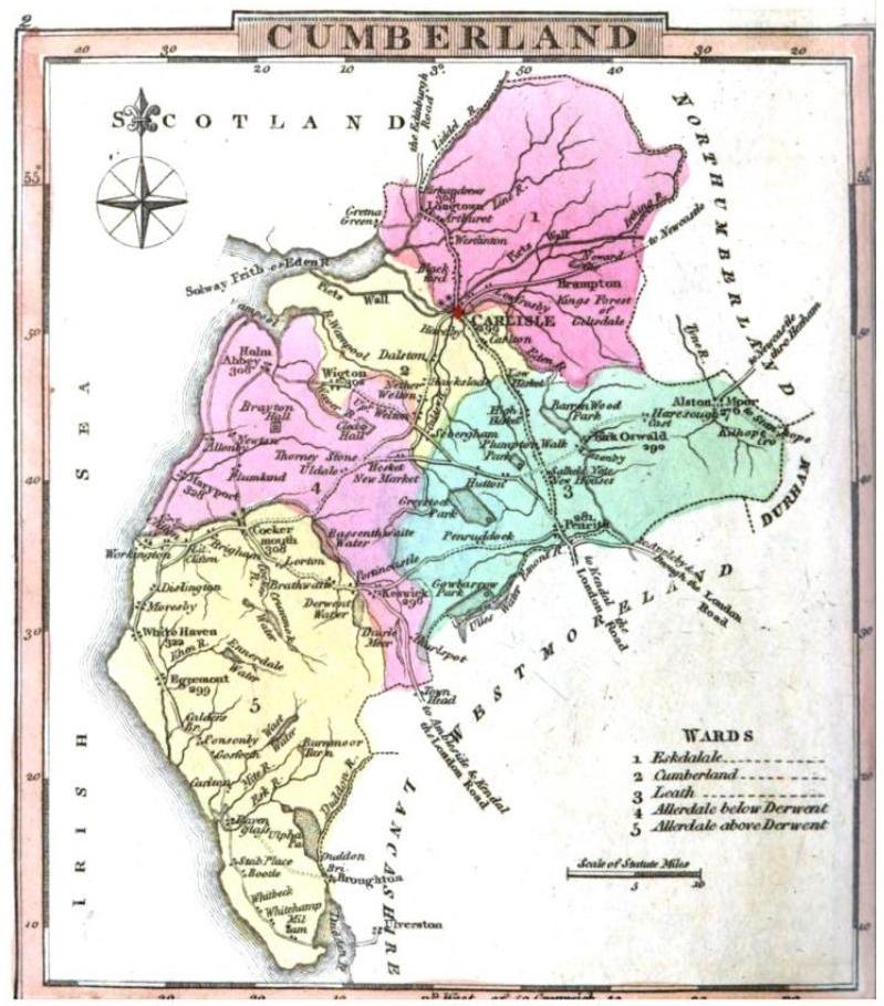
Micelness þisre forebysene: 527 be 600 dotta. Oðra metinga brædo: 211 be 240 dotta | 422 be 480 dotta | 799 be 909 dotta.
Frumlicu ymele (799 × 909 pixela, ymelan micelness: 119 KB, MIME cynn: image/jpeg)
| Towritenness | Cumberland | ||||
| Tælmearc | |||||
| Fruma | Gray's Book of Roads | ||||
| Dædfruma | George Carrington Gray | ||||
| Leaf (Eftnytt þisse ymelan) |
|
||||
Ymelan stær
Swing dæg/tide mid mys to seonne þa ymelan swa heo wæs on þære tide geywed.
| Dæg/Tid | Metungincel | Micelnesse gemetu | Brucend | Ymbspræc | |
|---|---|---|---|---|---|
| nu | 00:40, 21 Hreðmonað 2008 | | 799 × 909 (119 KB) | Smb1001 | {{Information |Description=Cumberland |Source=Gray's Book of Roads |Date=1824 |Author=George Carrington Gray |Permission=PD Google books * http://books.google.com }} {{PD-Google books}} Category:Old Maps of the United Kingdom (Gray 1824) |
Biliþbendas
Þā folgendan trametas bindaþ tō þissum biliðe:
Ymelan eormen nytt
Þas wiki brucaþ þissa ymelena:
- Nytt on azb.wikipedia.org
- Nytt on de.wikipedia.org
- Nytt on en.wikipedia.org
- Nytt on es.wikipedia.org
- Nytt on lt.wikipedia.org
- Nytt on nl.wikipedia.org