Ymele:Oklahoma topographic map-en.svg

Size of this PNG preview of this SVG file: 800 be 405 dotta. Oðra metinga brædo: 320 be 162 dotta | 640 be 324 dotta | 1,024 be 518 dotta | 1,280 be 648 dotta | 2,560 be 1,296 dotta | 3,952 be 2,000 dotta.
Frumlicu ymele (SVG ymele, rihte 3,952 × 2,000 pixela, ymelan micelness: 14.9 MB)
Scortness
| Towritenness |
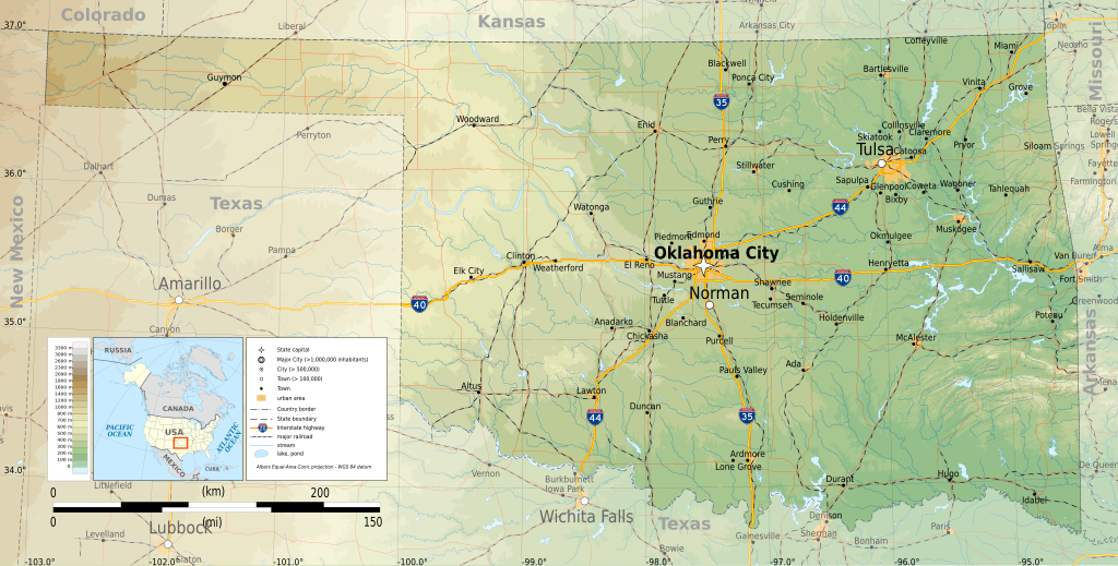
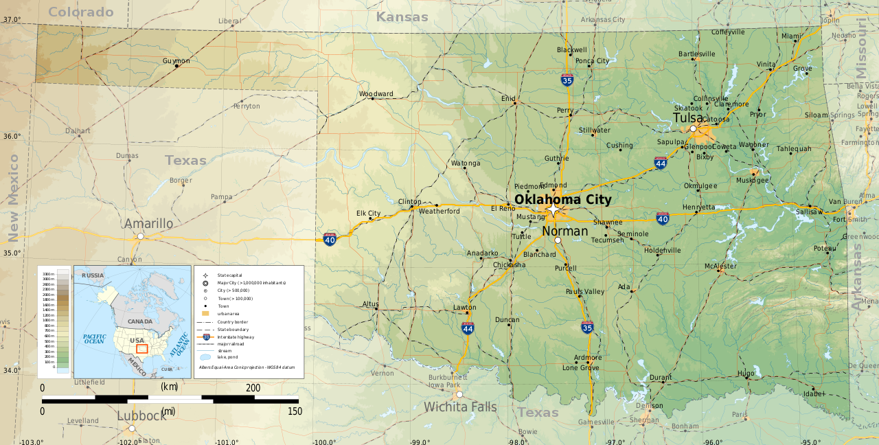
English: Topographic map of Oklahoma
Albers Equal-Area Conic projection, WGS84 datum Geographic limits of the map:
|
| Tælmearc | |
| Fruma |
Agen weorc
|
| Dædfruma | Ikonact |

|
This SVG file contains embedded text that can be translated into your language, using any capable SVG editor, text editor or the SVG Translate tool. For more information see: About translating SVG files. |
Leaf:
I, the copyright holder of this work, hereby publish it under the following license:
This file is licensed under the Creative Commons Attribution-Share Alike 4.0 International license.
- Þu most:
- bryttian – to copy, distribute and transmit the work
- to remix – andwendan þæt weorc
- Under the following conditions:
- hlígung – You must give appropriate credit, provide a link to the license, and indicate if changes were made. You may do so in any reasonable manner, but not in any way that suggests the licensor endorses you or your use.
- Efenlice bryttiendlic – Gif þu andwende þis weorc to ohte, þu scleat bryttian þæt andwendede weorc synderlice mid þære ilcan oþþe gelicre leafe swilcre þis brycþ.
Ymelan stær
Swing dæg/tide mid mys to seonne þa ymelan swa heo wæs on þære tide geywed.
| Dæg/Tid | Metungincel | Micelnesse gemetu | Brucend | Ymbspræc | |
|---|---|---|---|---|---|
| nu | 23:31, 9 Hreðmonað 2015 | | 3,952 × 2,000 (14.9 MB) | Ikonact | =={{int:filedesc}}== {{Information |description={{en|1=Topographic map of en:Oklahoma}} Albers Equal-Area Conic projection, WGS84 datum Geographic limits of the map: *West: 103.2° W *East: 94.2° W *North: 37.2° N *South: 33.4° N |date=2015-03... |
Biliþbendas
Þā folgendan trametas bindaþ tō þissum biliðe:
Ymelan eormen nytt
Þas wiki brucaþ þissa ymelena:
- Nytt on az.wikipedia.org
- Nytt on be.wikipedia.org
- Nytt on bg.wikipedia.org
- Nytt on ca.wikipedia.org
- Nytt on en.wikipedia.org
- Nytt on ga.wikipedia.org
- Nytt on gl.wikipedia.org
- Nytt on hu.wikipedia.org
- Nytt on hy.wikipedia.org
- Nytt on mhr.wikipedia.org
- Nytt on os.wikipedia.org
- Nytt on tg.wikipedia.org
- Nytt on tt.wikipedia.org
- Nytt on www.wikidata.org