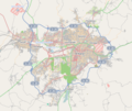
Ymele:Ankara road map.png

Micelness þisre forebysene: 718 be 600 dotta. Oðra metinga brædo: 287 be 240 dotta | 575 be 480 dotta | 920 be 768 dotta | 1,122 be 937 dotta.
Frumlicu ymele (1,122 × 937 pixela, ymelan micelness: 716 KB, MIME cynn: image/png)
Ymelan stær
Swing dæg/tide mid mys to seonne þa ymelan swa heo wæs on þære tide geywed.
| Dæg/Tid | Metungincel | Micelnesse gemetu | Brucend | Ymbspræc | |
|---|---|---|---|---|---|
| nu | 20:01, 17 Weodmonað 2014 |  | 1,122 × 937 (716 KB) | Ahmet Gürsakal | more bright |
| 19:51, 17 Weodmonað 2014 |  | 1,122 × 937 (694 KB) | Ahmet Gürsakal | more sharp | |
| 19:25, 17 Weodmonað 2014 |  | 576 × 487 (221 KB) | Ahmet Gürsakal | Reverted to version as of 18:45, 17 August 2014 | |
| 19:19, 17 Weodmonað 2014 |  | 576 × 487 (221 KB) | Ahmet Gürsakal | more sharp | |
| 18:45, 17 Weodmonað 2014 |  | 576 × 487 (221 KB) | Ahmet Gürsakal | {{Information |Description ={{en|1=Map of the road network of Ankara from Openstreetmap.}} |Source =http://www.openstreetmap.org/ |Author =OpenStreetMap contributors |Date =2014-0817 |Permission = |other_versions = }}... |
Biliþbendas
Þā folgendan trametas bindaþ tō þissum biliðe:
Ymelan eormen nytt
Þas wiki brucaþ þissa ymelena:
- Nytt on bn.wikipedia.org
- Nytt on bs.wikipedia.org
- Nytt on ca.wikipedia.org
- Nytt on en.wikipedia.org
- Nytt on ga.wikipedia.org
- Nytt on gl.wikipedia.org
- Nytt on hy.wikipedia.org
- Nytt on it.wikipedia.org
- Nytt on mrj.wikipedia.org
- Nytt on nl.wikipedia.org
- Nytt on sco.wikipedia.org
- Nytt on sv.wikivoyage.org
- Nytt on tr.wikipedia.org
- Nytt on tt.wikipedia.org
- Nytt on www.wikidata.org