Ymele:Bartonsville Covered Bridge.jpg
Micelness þisre forebysene: 800 be 482 dotta. Oðra metinga brædo: 320 be 193 dotta | 640 be 386 dotta | 1,024 be 617 dotta | 1,280 be 772 dotta | 2,100 be 1,266 dotta.
Frumlicu ymele (2,100 × 1,266 pixela, ymelan micelness: 547 KB, MIME cynn: image/jpeg)
|
This is an image of a place or building that is listed on the National Register of Historic Places in the United States of America. Its reference number is 73000201. |
Scortness
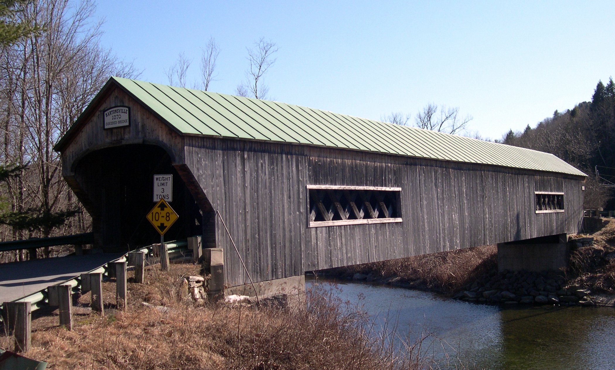
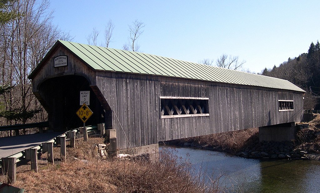
Bartonsville Covered Bridge, Bartonsville, Rockingham, Vermont
Leaf:
I, the copyright holder of this work, hereby publish it under the following licenses:

|
Permission is granted to copy, distribute and/or modify this document under the terms of the GNU Free Documentation License, Version 1.2 or any later version published by the Free Software Foundation; with no Invariant Sections, no Front-Cover Texts, and no Back-Cover Texts. A copy of the license is included in the section entitled GNU Free Documentation License. |
| This file is licensed under the Creative Commons Attribution-Share Alike 3.0 Unported license. | ||
| ||
| This licensing tag was added to this file as part of the GFDL licensing update. |
This file is licensed under the Creative Commons Attribution-Share Alike 2.5 Generic, 2.0 Generic and 1.0 Generic license.
- Þu most:
- bryttian – to copy, distribute and transmit the work
- to remix – andwendan þæt weorc
- Under the following conditions:
- hlígung – You must give appropriate credit, provide a link to the license, and indicate if changes were made. You may do so in any reasonable manner, but not in any way that suggests the licensor endorses you or your use.
- Efenlice bryttiendlic – Gif þu andwende þis weorc to ohte, þu scleat bryttian þæt andwendede weorc synderlice mid þære ilcan oþþe gelicre leafe swilcre þis brycþ.
Þu most ceosan leafe
| Object location | | View this and other nearby images on: OpenStreetMap |
|---|
Ymelan stær
Swing dæg/tide mid mys to seonne þa ymelan swa heo wæs on þære tide geywed.
| Dæg/Tid | Metungincel | Micelnesse gemetu | Brucend | Ymbspræc | |
|---|---|---|---|---|---|
| nu | 01:19, 28 Hreðmonað 2006 | | 2,100 × 1,266 (547 KB) | Sfoskett~commonswiki | Bartonsville Covered Bridge, Bartonsville, Rockingham, Vermont Category:Vermont covered bridges |
Biliþbendas
Þā folgendan trametas bindaþ tō þissum biliðe:
Ymelan eormen nytt
Þas wiki brucaþ þissa ymelena:
- Nytt on am.wikipedia.org
- Nytt on an.wikipedia.org
- Nytt on az.wikipedia.org
- Nytt on bcl.wikipedia.org
- Nytt on be-tarask.wikipedia.org
- Nytt on be.wikipedia.org
- Nytt on bg.wikipedia.org
- Nytt on bi.wikipedia.org
- Nytt on co.wikipedia.org
- Nytt on cv.wikipedia.org
- Nytt on cy.wikipedia.org
- Nytt on da.wikipedia.org
- Nytt on de.wikipedia.org
- Nytt on diq.wikipedia.org
- Nytt on el.wikipedia.org
- Nytt on en.wikipedia.org
- Nytt on et.wikipedia.org
- Nytt on eu.wikipedia.org
- Nytt on fo.wikipedia.org
- Nytt on frp.wikipedia.org
- Nytt on frr.wikipedia.org
- Nytt on gd.wikipedia.org
- Nytt on gl.wikipedia.org
- Nytt on gn.wikipedia.org
- Nytt on haw.wikipedia.org
- Nytt on hif.wikipedia.org
- Nytt on hi.wikipedia.org
- Nytt on hr.wikipedia.org
- Nytt on ik.wikipedia.org
- Nytt on incubator.wikimedia.org
- Nytt on io.wikipedia.org
- Nytt on is.wikipedia.org
- Nytt on jv.wikipedia.org
- Nytt on kab.wikipedia.org
- Nytt on ku.wikipedia.org
- Nytt on kw.wikipedia.org
- Nytt on la.wikipedia.org
- Nytt on li.wikipedia.org
- Nytt on mhr.wikipedia.org
- Nytt on mk.wikipedia.org
- Nytt on ml.wikipedia.org
- Nytt on mrj.wikipedia.org
- Nytt on ms.wikipedia.org
- Nytt on nn.wikipedia.org
- Nytt on no.wikipedia.org
View more global usage of this file.