Ymele:Censusdivisions.PNG

Micelness þisre forebysene: 685 be 599 dotta. Oðra metinga brædo: 274 be 240 dotta | 549 be 480 dotta | 878 be 768 dotta | 1,171 be 1,024 dotta | 1,388 be 1,214 dotta.
Frumlicu ymele (1,388 × 1,214 pixela, ymelan micelness: 105 KB, MIME cynn: image/png)
Scortness
| Towritenness | |
| Tælmearc | 30 Winterfylleð 2005 (upload date) |
| Fruma | Transferred from en.wikipedia to Commons. |
| Dædfruma | Earl Andrew at English Ƿikipǣdia |

|
This locator map image could be re-created using vector graphics as an SVG file. This has several advantages; see Commons:Media for cleanup for more information. If an SVG form of this image is available, please upload it and afterwards replace this template with
{{vector version available|new image name}}.
It is recommended to name the SVG file “Censusdivisions.svg”—then the template Vector version available (or Vva) does not need the new image name parameter. |
Leaf:
| |
This work has been released into the public domain by its author, Earl Andrew, at the English Ƿikipǣdia project. This applies worldwide. In case this is not legally possible: |
Ymelan stær
Swing dæg/tide mid mys to seonne þa ymelan swa heo wæs on þære tide geywed.
| Dæg/Tid | Metungincel | Micelnesse gemetu | Brucend | Ymbspræc | |
|---|---|---|---|---|---|
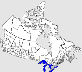
| nu | 02:52, 4 Sēremōnaþ 2016 | | 1,388 × 1,214 (105 KB) | Kingofthedead | Reverted to version as of 15:24, 30 October 2005 (UTC) this is to be a blank map and borders do not need to be highlighted |
| 14:08, 29 Winterfylleð 2015 |  | 1,388 × 1,214 (75 KB) | Nwbeeson | Corrected error. There is no '''land''' boundary between the United States and Ontario. This is a common error, but an error nonetheless. | |
| 15:24, 30 Winterfylleð 2005 |  | 1,388 × 1,214 (105 KB) | Fralambert | '''fr:''' Division de recensement au Canada. Source: en:Image:Censusdivisions.PNG (à voir pour licence) Auteur: en:User:Earl Andrew Category:Canada |
Biliþbendas
Þā folgendan trametas bindaþ tō þissum biliðe:
Ymelan eormen nytt
Þas wiki brucaþ þissa ymelena:
- Nytt on ca.wikipedia.org
- Nytt on de.wikipedia.org
- Nytt on en.wikipedia.org
- Nytt on fr.wikipedia.org
- Nytt on it.wikipedia.org
- Nytt on pl.wikipedia.org
- Nytt on pt.wikipedia.org
- Nytt on ru.wikipedia.org
- Nytt on uk.wikipedia.org
- Nytt on zh.wikipedia.org