Ymele:Denmark location map.svg

Size of this PNG preview of this SVG file: 703 be 600 dotta. Oðra metinga brædo: 281 be 240 dotta | 563 be 480 dotta | 900 be 768 dotta | 1,201 be 1,024 dotta | 2,401 be 2,048 dotta | 1,836 be 1,566 dotta.
Frumlicu ymele (SVG ymele, rihte 1,836 × 1,566 pixela, ymelan micelness: 435 KB)
Scortness
| Towritenness |
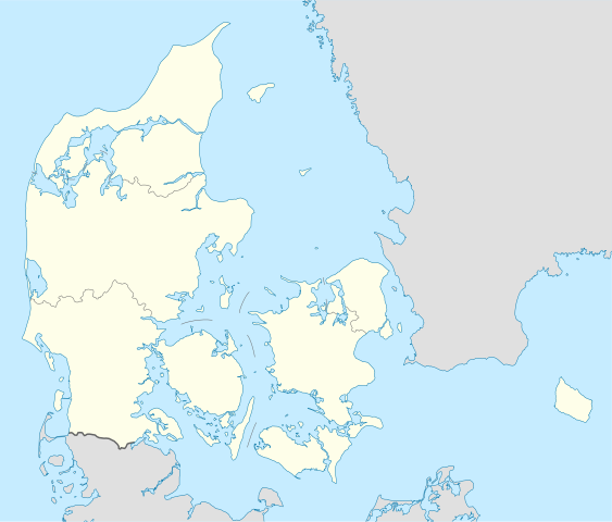
Deutsch: Positionskarte von Dänemark
Quadratische Plattkarte, N-S-Streckung 180 %. Geographische Begrenzung der Karte:
English: Location map of Denmark
Equirectangular projection, N/S stretching 180 %. Geographic limits of the map:
|
||
| Tælmearc | |||
| Fruma | Agen weorc, using United States National Imagery and Mapping Agency data | ||
| Dædfruma | NordNordWest | ||
| Other versions | Derivative works of this file: Regenbogen location map.svg | ||
| SVG genesis |
|

Leaf:
I, the copyright holder of this work, hereby publish it under the following licenses:

|
Permission is granted to copy, distribute and/or modify this document under the terms of the GNU Free Documentation License, Version 1.2 or any later version published by the Free Software Foundation; with no Invariant Sections, no Front-Cover Texts, and no Back-Cover Texts. A copy of the license is included in the section entitled GNU Free Documentation License. |
This file is licensed under the Creative Commons Attribution-Share Alike 3.0 Unported license.
- Þu most:
- bryttian – to copy, distribute and transmit the work
- to remix – andwendan þæt weorc
- Under the following conditions:
- hlígung – You must give appropriate credit, provide a link to the license, and indicate if changes were made. You may do so in any reasonable manner, but not in any way that suggests the licensor endorses you or your use.
- Efenlice bryttiendlic – Gif þu andwende þis weorc to ohte, þu scleat bryttian þæt andwendede weorc synderlice mid þære ilcan oþþe gelicre leafe swilcre þis brycþ.
Þu most ceosan leafe
Ymelan stær
Swing dæg/tide mid mys to seonne þa ymelan swa heo wæs on þære tide geywed.
| Dæg/Tid | Metungincel | Micelnesse gemetu | Brucend | Ymbspræc | |
|---|---|---|---|---|---|
| nu | 15:30, 25 Blotmonað 2022 | | 1,836 × 1,566 (435 KB) | GrandEscogriffe | more correct north-south stretching |
| 18:57, 25 Weodmonað 2008 |  | 1,836 × 1,479 (441 KB) | NordNordWest | size correction | |
| 08:53, 2 Mædmonað 2008 |  | 612 × 493 (434 KB) | NordNordWest | {{Information |Description= {{de|Positionskarte von Dänemark}} Quadratische Plattkarte, N-S-Streckung 170 %. Geographische Begrenzung der Karte: * N: 57.9° N * S: 54.3° N * W: 8.8° O * O: 15.4° O {{en|Location map of [[:en:Denmark|D |
Biliþbendas
Þǣr sind nāne trametas þe bindaþ tō þissum biliðe.
Ymelan eormen nytt
Þas wiki brucaþ þissa ymelena:
- Nytt on af.wikipedia.org
- Nytt on ar.wikipedia.org
- Nytt on az.wikipedia.org
- Nytt on ba.wikipedia.org
- Nytt on be-tarask.wikipedia.org
- Капэнгаген
- Гэрнінг
- Шаблён:Лякалізацыйная мапа Даніі
- Одэнсэ
- Лянгелян
- Фальстэр
- Стрэймай
- Сувурай
- Фуглёй
- Эстурой
- Сандой
- Кальсой
- Скувой
- Вагар
- Наўльсой
- Люйтля-Дуймун
- Віёй
- Свуйной
- Скаген
- Оргус
- Чэмпіянат Эўропы па гандболе сярод мужчынаў 2014 году
- Брэнбю
- Ольбарг
- Ранэрс
- Эсб’ерг
- Кольдынг
- Горсэнс
- Вайле
- Роскіле
- Гэльсынгёр
- Сылькебарг
- Нэствэд
- Фрэдэрысія
View more global usage of this file.