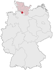
Ymele:Lage des Kreises Pinneberg in Deutschland.png
Lage_des_Kreises_Pinneberg_in_Deutschland.png (176 × 234 pixela, ymelan micelness: 4 KB, MIME cynn: image/png)
Ymelan stær
Swing dæg/tide mid mys to seonne þa ymelan swa heo wæs on þære tide geywed.
| Dæg/Tid | Metungincel | Micelnesse gemetu | Brucend | Ymbspræc | |
|---|---|---|---|---|---|
| nu | 12:21, 5 Eastermonað 2007 |  | 176 × 234 (4 KB) | Ditschi | transparent |
| 09:19, 3 Hreðmonað 2006 |  | 176 × 234 (4 KB) | Rauenstein | Karte erstellt auf der Grundlage der opengeodb.de-Umrisse - GNU-FDL Geograv 00:54, 31. Dez 2004 {{Bild-GFDL}} Category:Maps of Germany |
Biliþbendas
Þā folgendan trametas bindaþ tō þissum biliðe:
Ymelan eormen nytt
Þas wiki brucaþ þissa ymelena:
- Nytt on ace.wikipedia.org
- Nytt on am.wikipedia.org
- Nytt on arc.wikipedia.org
- Nytt on av.wikipedia.org
- Nytt on ay.wikipedia.org
- Nytt on bcl.wikipedia.org
- Nytt on bi.wikipedia.org
- Nytt on bm.wikipedia.org
- Nytt on bpy.wikipedia.org
- Nytt on bxr.wikipedia.org
- Nytt on cbk-zam.wikipedia.org
- Nytt on ceb.wikipedia.org
- Nytt on ch.wikipedia.org
- Nytt on cr.wikipedia.org
- Nytt on cs.wikipedia.org
- Nytt on cu.wikipedia.org
- Nytt on cv.wikipedia.org
- Nytt on cy.wikipedia.org
- Nytt on dsb.wikipedia.org
- Nytt on dv.wikipedia.org
- Nytt on dz.wikipedia.org
- Nytt on eml.wikipedia.org
- Nytt on eo.wikipedia.org
- Nytt on es.wikipedia.org
- Nytt on ext.wikipedia.org
- Nytt on ff.wikipedia.org
- Nytt on fiu-vro.wikipedia.org
- Nytt on fj.wikipedia.org
- Nytt on fo.wikipedia.org
- Nytt on frp.wikipedia.org
- Nytt on frr.wikipedia.org
- Nytt on fr.wikipedia.org
- Nytt on fur.wikipedia.org
- Nytt on fy.wikipedia.org
- Nytt on gag.wikipedia.org
- Nytt on gn.wikipedia.org
- Nytt on got.wikipedia.org
- Nytt on hak.wikipedia.org
- Nytt on haw.wikipedia.org
- Nytt on hif.wikipedia.org
- Nytt on hi.wikipedia.org
- Nytt on hr.wikipedia.org
- Nytt on ht.wikipedia.org
- Nytt on hy.wikipedia.org
- Nytt on id.wikipedia.org
- Nytt on ie.wikipedia.org
- Nytt on incubator.wikimedia.org
View more global usage of this file.
