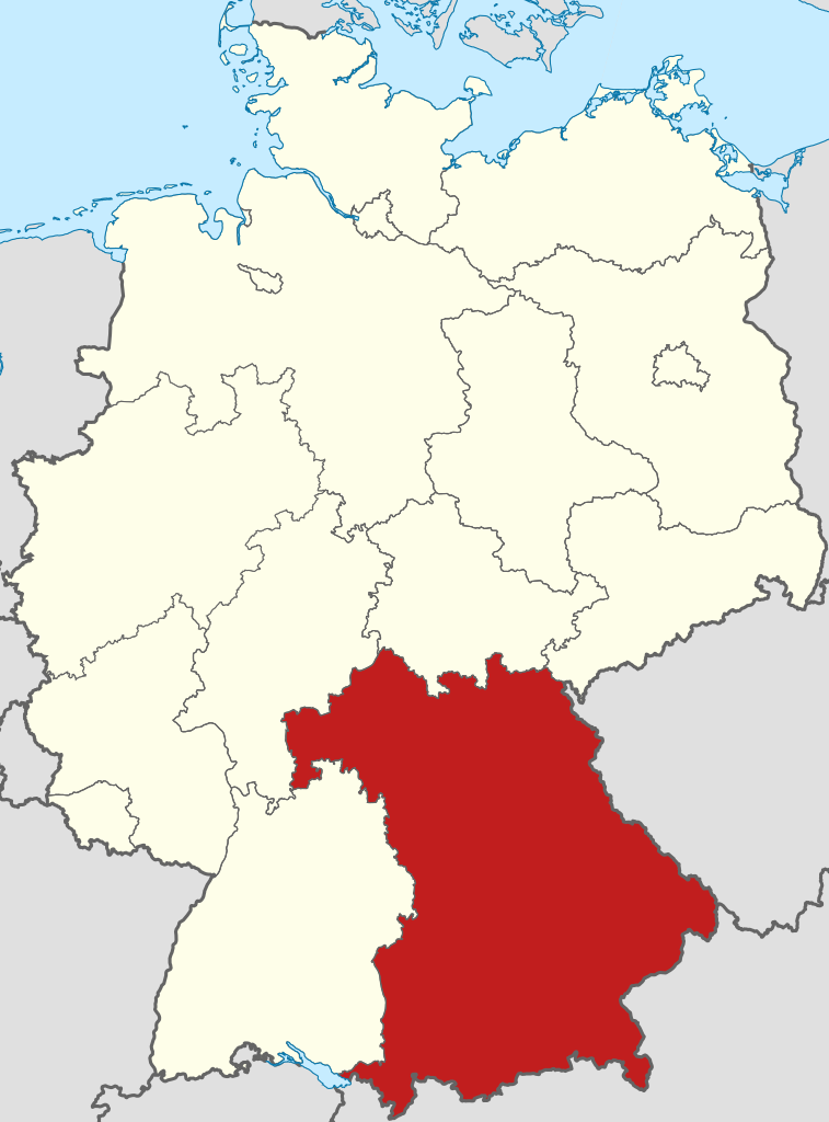
Ymele:Locator map Bavaria in Germany.svg

Size of this PNG preview of this SVG file: 443 be 599 dotta. Oðra metinga brædo: 177 be 240 dotta | 355 be 480 dotta | 567 be 768 dotta | 757 be 1,024 dotta | 1,513 be 2,048 dotta | 592 be 801 dotta.
Frumlicu ymele (SVG ymele, rihte 592 × 801 pixela, ymelan micelness: 668 KB)
Scortness
.svg)
.svg)
.svg)
.svg)
.svg)
.svg)
.svg)

-en.svg)

.svg)
.svg)
.svg)

_(US48).svg)
_(small_islands_magnified)_(-mini_map_-rivers).svg)
.svg)
_(extra_close)_(US48).svg)
.svg)
_(zoom).svg)

.svg)


_(UNMIK).svg)
.svg)
_(disputed_hatched).svg)
_(claimed_and_disputed_hatched).svg)
.svg)
.svg)
_(%2Ball_claims_hatched).svg)

.svg)
_(shade).svg)
_(shade)_(special_marker).svg)
_(-mini_map).svg)
_(-mini_map).svg)
_(-mini_map).svg)


.svg)

.svg)
Leaf:
I, the copyright holder of this work, hereby publish it under the following licenses:

|
Permission is granted to copy, distribute and/or modify this document under the terms of the GNU Free Documentation License, Version 1.2 or any later version published by the Free Software Foundation; with no Invariant Sections, no Front-Cover Texts, and no Back-Cover Texts. A copy of the license is included in the section entitled GNU Free Documentation License. |
This file is licensed under the Creative Commons Attribution-Share Alike 3.0 Unported, 2.5 Generic, 2.0 Generic and 1.0 Generic license.
- Þu most:
- bryttian – to copy, distribute and transmit the work
- to remix – andwendan þæt weorc
- Under the following conditions:
- hlígung – You must give appropriate credit, provide a link to the license, and indicate if changes were made. You may do so in any reasonable manner, but not in any way that suggests the licensor endorses you or your use.
- Efenlice bryttiendlic – Gif þu andwende þis weorc to ohte, þu scleat bryttian þæt andwendede weorc synderlice mid þære ilcan oþþe gelicre leafe swilcre þis brycþ.
Þu most ceosan leafe
Ymelan stær
Swing dæg/tide mid mys to seonne þa ymelan swa heo wæs on þære tide geywed.
| Dæg/Tid | Metungincel | Micelnesse gemetu | Brucend | Ymbspræc | |
|---|---|---|---|---|---|
| nu | 17:51, 11 Hreðmonað 2009 | | 592 × 801 (668 KB) | TUBS | =={{int:filedesc}}== {{Information |Description= {{de|Lage von Bavaria in Deutschland}} {{en|Locator map of Bavaria in Germany.}} |Source= {{de|Eigene Arbeit}} {{en|Own work}} |Date=2009 |
Biliþbendas
Þā folgendan trametas bindaþ tō þissum biliðe:
Ymelan eormen nytt
Þas wiki brucaþ þissa ymelena:
- Nytt on af.wikipedia.org
- Nytt on als.wikipedia.org
- Nytt on ar.wikipedia.org
- Nytt on ary.wikipedia.org
- Nytt on arz.wikipedia.org
- Nytt on ast.wikipedia.org
- Nytt on ast.wiktionary.org
- Nytt on ay.wikipedia.org
- Nytt on az.wikipedia.org
- Nytt on be-tarask.wikipedia.org
- Nytt on be.wikipedia.org
- Nytt on ca.wikipedia.org
- Nytt on ceb.wikipedia.org
- Nytt on crh.wikipedia.org
- Nytt on csb.wikipedia.org
- Nytt on cs.wikipedia.org
- Nytt on da.wikipedia.org
- Naturpark Altmühltal
- Naturpark Frankenhöhe
- Naturpark Spessart
- Naturpark Augsburg-Westliche Wälder
- Naturpark Haßberge
- Naturpark Fichtelgebirge
- Naturpark Fränkische Schweiz-Veldensteiner Forst
- Geo-Naturpark Bergstraße-Odenwald
- Skabelon:Naturparker i Bayern
- Naturpark Bayerische Rhön
- Naturpark Frankenwald
- Naturpark Hirschwald
- Naturpark Nagelfluhkette
- Naturpark Nördlicher Oberpfälzer Wald
- Naturpark Oberer Bayerischer Wald
- Naturpark Oberpfälzer Wald
- Nytt on de.wikipedia.org
View more global usage of this file.