Ymele:Map of California highlighting San Joaquin County.svg

Size of this PNG preview of this SVG file: 521 be 599 dotta. Oðra metinga brædo: 209 be 240 dotta | 417 be 480 dotta | 667 be 768 dotta | 890 be 1,024 dotta | 1,780 be 2,048 dotta | 916 be 1,054 dotta.
Frumlicu ymele (SVG ymele, rihte 916 × 1,054 pixela, ymelan micelness: 151 KB)
Scortness
| Towritenness |
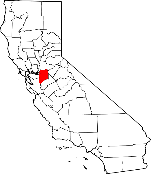
English: This is a locator map showing San Joaquin County in California. For more information, see Commons:United States county locator maps. |
| Tælmearc | |
| Fruma |
Agen weorc: English: The maps use data from nationalatlas.gov, specifically countyp020.tar.gz on the Raw Data Download page. The maps also use state outline data from statesp020.tar.gz. The Florida maps use hydrogm020.tar.gz to display Lake Okeechobee. |
| Dædfruma | David Benbennick |
Leaf:
| I, the copyright holder of this work, release this work into the public domain. This applies worldwide. In some countries this may not be legally possible; if so: I grant anyone the right to use this work for any purpose, without any conditions, unless such conditions are required by law. |
Ymelan stær
Swing dæg/tide mid mys to seonne þa ymelan swa heo wæs on þære tide geywed.
| Dæg/Tid | Metungincel | Micelnesse gemetu | Brucend | Ymbspræc | |
|---|---|---|---|---|---|
| nu | 23:03, 25 Sēremōnaþ 2024 | | 916 × 1,054 (151 KB) | Nux | uniform colors with good contrast |
| 10:27, 12 Solmonaþ 2006 |  | 9,164 × 10,536 (229 KB) | David Benbennick | {{subst:User:Dbenbenn/clm|county=San Joaquin County|state=California}} |
Biliþbendas
Þā folgendan trametas bindaþ tō þissum biliðe:
Ymelan eormen nytt
Þas wiki brucaþ þissa ymelena:
- Nytt on ar.wikipedia.org
- Nytt on az.wikipedia.org
- Nytt on ban.wikipedia.org
- Nytt on be.wikipedia.org
- Nytt on bg.wikipedia.org
- Nytt on bpy.wikipedia.org
- Nytt on ca.wikipedia.org
- Nytt on ceb.wikipedia.org
- Nytt on ce.wikipedia.org
- Nytt on cs.wikipedia.org
- Nytt on cy.wikipedia.org
- Nytt on da.wikipedia.org
- Nytt on de.wikipedia.org
- Nytt on en.wikipedia.org
- List of counties in California
- San Joaquin County, California
- Stockton, California
- August, California
- Country Club, California
- Escalon, California
- Farmington, California
- French Camp, California
- Garden Acres, California
- Kennedy, California
- Lathrop, California
- Lincoln Village, California
- Linden, California
- Lockeford, California
- Lodi, California
- Manteca, California
- Morada, California
- Ripon, California
- Taft Mosswood, California
- Tracy, California
- North Woodbridge, California
- South Woodbridge, California
- Victor, California
View more global usage of this file.