Ymele:Map of USA MA.svg

Size of this PNG preview of this SVG file: 286 be 186 dotta. Oðra metinga brædo: 320 be 208 dotta | 640 be 416 dotta | 1,024 be 666 dotta | 1,280 be 832 dotta | 2,560 be 1,665 dotta.
Frumlicu ymele (SVG ymele, rihte 286 × 186 pixela, ymelan micelness: 167 KB)
Clickable version
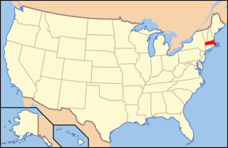
| Towritenness | Map of USA with Massachusetts highlighted | ||||||||
| Tælmearc | see file history below. | ||||||||
| Fruma | own work by uploader, based on Image:Map of USA without state names.svg | ||||||||
| Dædfruma |
This version: uploader Base versions this one is derived from: originally created by en:User:Wapcaplet |
||||||||
| Leaf (Eftnytt þisse ymelan) |
This file is licensed under the Creative Commons Attribution 2.0 Generic license.
|
||||||||
| Other versions | image:Map of USA with state names.svg |

Ymelan stær
Swing dæg/tide mid mys to seonne þa ymelan swa heo wæs on þære tide geywed.
| Dæg/Tid | Metungincel | Micelnesse gemetu | Brucend | Ymbspræc | |
|---|---|---|---|---|---|
| nu | 07:00, 9 Sēremōnaþ 2006 | | 286 × 186 (167 KB) | Huebi~commonswiki | {{Information| |Description=Map of USA with Massachusettes highlighted |other_versions=image:Map of USA with state names.svg }} Category:Maps of the United States Category:Maps of Massachusettes Category:SVG maps {{GFDL-en}}{{cc-by-2.0} |
Biliþbendas
Þā folgendan trametas bindaþ tō þissum biliðe:
Ymelan eormen nytt
Þas wiki brucaþ þissa ymelena:
- Nytt on af.wikipedia.org
- Nytt on arc.wikipedia.org
- Nytt on ay.wikipedia.org
- Nytt on az.wiktionary.org
- Nytt on ba.wikipedia.org
- Nytt on bcl.wikipedia.org
- Nytt on be-tarask.wikipedia.org
- Nytt on bi.wikipedia.org
- Nytt on bpy.wikipedia.org
- Nytt on bxr.wikipedia.org
- Nytt on ca.wikipedia.org
- Nytt on ce.wikipedia.org
- Nytt on co.wikipedia.org
- Nytt on cs.wikipedia.org
- Administrativní dělení Spojených států amerických
- Cambridge (Massachusetts)
- Winchendon
- Uxbridge (Massachusetts)
- Provincetown
- Williamstown (Massachusetts)
- Leicester (Massachusetts)
- South Deerfield
- Sterling (Massachusetts)
- Salem (Massachusetts)
- Beverly (Massachusetts)
- Peabody (Massachusetts)
- Concord (Massachusetts)
- Foxborough
- Amherst
- Webster (Massachusetts)
- Fitchburg (Massachusetts)
- Oxford (Massachusetts)
- Shrewsbury (Massachusetts)
- Berlin (Massachusetts)
- Nytt on cu.wikipedia.org
- Nytt on cv.wikipedia.org
- Nytt on da.wikipedia.org
View more global usage of this file.