Ymele:Map of USA with county outlines.png

Micelness þisre forebysene: 800 be 520 dotta. Oðra metinga brædo: 320 be 208 dotta | 640 be 416 dotta | 1,024 be 665 dotta | 1,513 be 983 dotta.
Frumlicu ymele (1,513 × 983 pixela, ymelan micelness: 581 KB, MIME cynn: image/png)

|
This locator map image could be re-created using vector graphics as an SVG file. This has several advantages; see Commons:Media for cleanup for more information. If an SVG form of this image is available, please upload it and afterwards replace this template with
{{vector version available|new image name}}.
It is recommended to name the SVG file “Map of USA with county outlines.svg”—then the template Vector version available (or Vva) does not need the new image name parameter. |
Scortness
| Towritenness |
Deutsch: Karte der Vereinigten Staaten mit den Staats- und Kreisgrenzen.
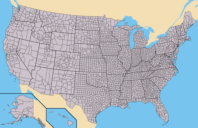
English: Map of the USA showing borders of states and counties. Colored version of adapted one by Wapcaplet from a public-domain map courtesy of the U.S. Census Bureau website first published in English language version of Wikipedia.
Español: Mapa de los es:Estados Unidos mostrando los los límites de estados miembros y sus condados. Versión a colores de la adaptación hecha por Wapcaplet del mapa de dominio público del sitio web de la Oficina de Censo de los EE.UU.. |
| Tælmearc | |
| Fruma | https://www.census.gov |
| Dædfruma | |
| Other versions | Derivative works of this file: Emancipation Proclamation.PNG |
Leaf:

|
Permission is granted to copy, distribute and/or modify this document under the terms of the GNU Free Documentation License, Version 1.2 or any later version published by the Free Software Foundation; with no Invariant Sections, no Front-Cover Texts, and no Back-Cover Texts. A copy of the license is included in the section entitled GNU Free Documentation License. |
| This file is licensed under the Creative Commons Attribution-Share Alike 3.0 Unported license. | ||
| ||
| This licensing tag was added to this file as part of the GFDL licensing update. |
Ymelan stær
Swing dæg/tide mid mys to seonne þa ymelan swa heo wæs on þære tide geywed.
| Dæg/Tid | Metungincel | Micelnesse gemetu | Brucend | Ymbspræc | |
|---|---|---|---|---|---|
| nu | 16:25, 31 Þrimilcemonað 2015 | | 1,513 × 983 (581 KB) | Cmdrjameson | Compressed with pngout. Reduced by 484kB (45% decrease). |
| 14:02, 21 Haligmonað 2010 |  | 1,513 × 983 (1.04 MB) | Kmusser | fix Pamlico Sound | |
| 23:31, 25 Blotmonað 2009 |  | 1,513 × 983 (166 KB) | Reywas92 | Make borders more visible. | |
| 04:41, 23 Se Æfterra Gēola 2008 |  | 1,513 × 983 (98 KB) | Speight | Fix San Francisco Bay and Puget Sound | |
| 22:53, 23 Blotmonað 2006 |  | 1,513 × 983 (165 KB) | Ibagli | more fixes | |
| 22:53, 23 Blotmonað 2006 |  | 1,513 × 983 (165 KB) | Ibagli | Reverted to earlier revision | |
| 22:52, 23 Blotmonað 2006 |  | 1,513 × 983 (180 KB) | Ibagli | more fixes | |
| 02:16, 23 Blotmonað 2006 |  | 1,513 × 983 (165 KB) | Ibagli | fix lake St. Clair | |
| 20:57, 28 Weodmonað 2005 |  | 1,513 × 983 (165 KB) | Huhsunqu | *{{es}} Mapa de los Estados Unidos de América mostrando los los límites de estados miembros y sus condados. Versión a colores de la adaptación hecha por Wapcaplet del mapa de dominio público del [http://www.census.gov/ sitio |
Biliþbendas
Þā folgendan trametas bindaþ tō þissum biliðe:
Ymelan eormen nytt
Þas wiki brucaþ þissa ymelena:
- Nytt on az.wikipedia.org
- Nytt on bg.wikipedia.org
- Nytt on ca.wikipedia.org
- Nytt on cs.wikipedia.org
- Nytt on de.wikipedia.org
- Nytt on en.wikipedia.org
- Talk:Bigfoot/Archive 5
- Talk:Manhattan
- Talk:Los Angeles County, California
- Talk:List of counties in Nevada
- Talk:Louisville, Kentucky
- Wikipedia:WikiProject U.S. counties
- Wikipedia talk:WikiProject U.S. counties
- Talk:Lancaster County, Pennsylvania
- Talk:Frederick County, Maryland
- Talk:Franklin County, Tennessee
- Talk:Trumbull County, Ohio
- Talk:Tuscarawas County, Ohio
- Talk:Union County, Ohio
- Talk:Van Wert County, Ohio
- Talk:Vinton County, Ohio
- Talk:Warren County, Ohio
- Talk:Washington County, Ohio
- Talk:Wayne County, Ohio
- Talk:Williams County, Ohio
- Talk:Wood County, Ohio
- Talk:Wyandot County, Ohio
- Talk:Adair County, Oklahoma
- Talk:Alfalfa County, Oklahoma
- Talk:Atoka County, Oklahoma
- Talk:Blaine County, Oklahoma
- Talk:Bryan County, Oklahoma
- Talk:Caddo County, Oklahoma
- Talk:Carter County, Oklahoma
- Talk:Cherokee County, Oklahoma
- Talk:Nantucket
- Talk:Potter County, South Dakota
- Talk:Weston County, Wyoming
- Talk:Washakie County, Wyoming
- Talk:Uinta County, Wyoming
- Talk:Teton County, Wyoming
- Talk:Sweetwater County, Wyoming
- Talk:Sublette County, Wyoming
- Talk:Sheridan County, Wyoming
- Talk:Platte County, Wyoming
View more global usage of this file.