Ymele:US-IN-Indianapolis.png

Micelness þisre forebysene: 384 be 600 dotta. Oðra metinga brædo: 153 be 240 dotta | 512 be 800 dotta.
Frumlicu ymele (512 × 800 pixela, ymelan micelness: 33 KB, MIME cynn: image/png)

|
This locator map image could be re-created using vector graphics as an SVG file. This has several advantages; see Commons:Media for cleanup for more information. If an SVG form of this image is available, please upload it and afterwards replace this template with
{{vector version available|new image name}}.
It is recommended to name the SVG file “US-IN-Indianapolis.svg”—then the template Vector version available (or Vva) does not need the new image name parameter. |
Scortness
English:
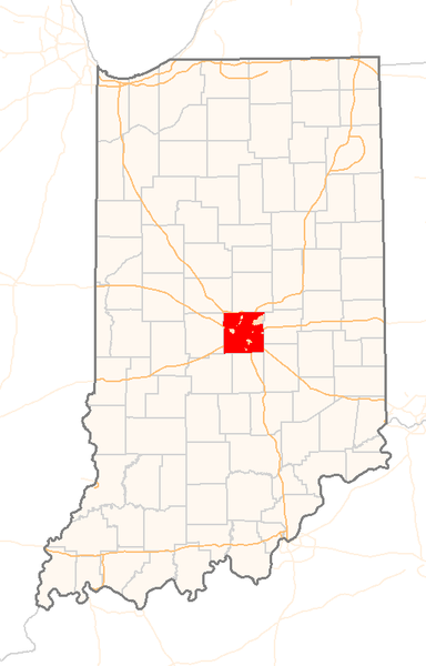
| Towritenness | Red Dot map of Indiana, showing the location of Indianapolis |
| Tælmearc | (UTC) |
| Fruma | Self-made with a custom-made GIS application from public data sources |
| Dædfruma | Sean Baker ( Marvin01 | talk ) |
| Leaf (Eftnytt þisse ymelan) |
Free use, with attribution, under the Cc-by-2.0 license (see below). If you copy this image to modify it for another purpose, please respect the terms of this license and add a link back to the original image on the description page, or contact me to waive this restriction. |
| Other versions | none |
Leaf:
This file is licensed under the Creative Commons Attribution 2.0 Generic license.
- Þu most:
- bryttian – to copy, distribute and transmit the work
- to remix – andwendan þæt weorc
- Under the following conditions:
- hlígung – You must give appropriate credit, provide a link to the license, and indicate if changes were made. You may do so in any reasonable manner, but not in any way that suggests the licensor endorses you or your use.
Ymelan stær
Swing dæg/tide mid mys to seonne þa ymelan swa heo wæs on þære tide geywed.
| Dæg/Tid | Metungincel | Micelnesse gemetu | Brucend | Ymbspræc | |
|---|---|---|---|---|---|
| nu | 07:14, 22 Winterfylleð 2005 | | 512 × 800 (33 KB) | Marvin01 | {{User:Marvin01/Template:US-IN-Information|city=Indianapolis|date=~~~~~}} Category:Locator_maps_of_cities_in_Indiana |
| 21:41, 19 Winterfylleð 2005 |  | 280 × 400 (8 KB) | Marvin01 | {{User:Marvin01/Template:US-IN-Information|city=Indianapolis|date=~~~~~}} | |
| 20:35, 19 Winterfylleð 2005 |  | 256 × 400 (13 KB) | Marvin01 | {{User:Marvin01/Template:US-IN-Information|city=Indianapolis|date=~~~~~}} |
Biliþbendas
Þā folgendan trametas bindaþ tō þissum biliðe:
Ymelan eormen nytt
Þas wiki brucaþ þissa ymelena:
- Nytt on ar.wikipedia.org
- Nytt on arz.wikipedia.org
- Nytt on ast.wikipedia.org
- Nytt on ca.wikipedia.org
- Nytt on ceb.wikipedia.org
- Nytt on diq.wikipedia.org
- Nytt on el.wikipedia.org
- Nytt on en.wikipedia.org
- Nytt on eo.wikipedia.org
- Nytt on es.wikipedia.org
- Nytt on et.wikipedia.org
- Nytt on eu.wikipedia.org
- Nytt on ga.wikipedia.org
- Nytt on gl.wikipedia.org
- Nytt on ht.wikipedia.org
- Nytt on hu.wikipedia.org
- Nytt on ia.wikipedia.org
- Nytt on ie.wikipedia.org
- Nytt on kab.wikipedia.org
- Nytt on la.wikipedia.org
- Nytt on nl.wikipedia.org
- Nytt on oc.wikipedia.org
- Nytt on pam.wikipedia.org
- Nytt on tl.wikipedia.org
- Nytt on tt.wikipedia.org
- Nytt on vo.wikipedia.org
- Nytt on www.wikidata.org