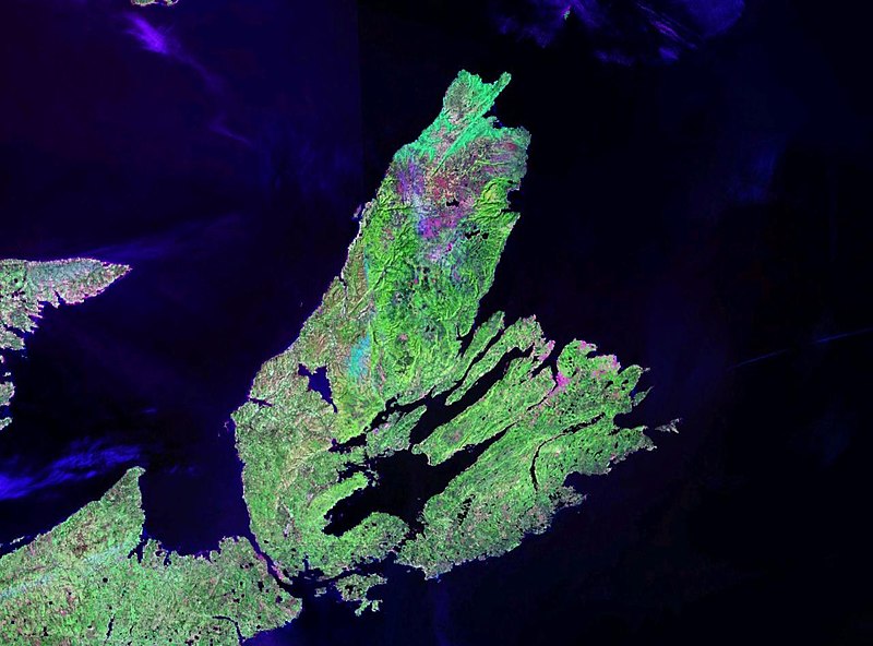
Ymele:Wfm cape breton island pseudocolour.jpg

Micelness þisre forebysene: 800 be 593 dotta. Oðra metinga brædo: 320 be 237 dotta | 640 be 474 dotta | 1,024 be 758 dotta | 1,280 be 948 dotta.
Frumlicu ymele (1,280 × 948 pixela, ymelan micelness: 130 KB, MIME cynn: image/jpeg)
| Towritenness | Cape Breton Island |
| Tælmearc | Unknown date |
| Fruma | NASA Landsat |
| Dædfruma | NASA |
| Leaf (Eftnytt þisse ymelan) |
usgov-PD |
| This image is in the public domain because it is a screenshot from NASA’s globe software World Wind using a public domain layer, such as Blue Marble, MODIS, Landsat, SRTM, USGS or GLOBE.
|
 |
Ymelan stær
Swing dæg/tide mid mys to seonne þa ymelan swa heo wæs on þære tide geywed.
| Dæg/Tid | Metungincel | Micelnesse gemetu | Brucend | Ymbspræc | |
|---|---|---|---|---|---|
| nu | 21:09, 28 Eastermonað 2006 | | 1,280 × 948 (130 KB) | Finlay McWalter | {{Information| |Description=Cape Breton Island |Source=NASA Landsat |Date=? |Author=NASA |Permission=usgov-PD |other_versions= }} {{PD-WorldWind}} Category:Satellite images of islands Category:Satellite pictures of Canada |
Biliþbendas
Þā folgendan trametas bindaþ tō þissum biliðe:
Ymelan eormen nytt
Þas wiki brucaþ þissa ymelena:
- Nytt on af.wikipedia.org
- Nytt on ar.wikipedia.org
- Nytt on arz.wikipedia.org
- Nytt on bg.wikipedia.org
- Nytt on ca.wikipedia.org
- Nytt on el.wikipedia.org
- Nytt on en.wikipedia.org
- Nytt on eo.wikipedia.org
- Nytt on es.wikipedia.org
- Nytt on et.wikipedia.org
- Nytt on fr.wikipedia.org
- Nytt on gl.wikipedia.org
- Nytt on gv.wikipedia.org
- Nytt on hr.wikipedia.org
- Nytt on it.wikipedia.org
- Nytt on ka.wikipedia.org
- Nytt on ko.wikipedia.org
- Nytt on la.wikipedia.org
- Nytt on nl.wikipedia.org
- Nytt on nn.wikipedia.org
- Nytt on no.wikipedia.org
- Nytt on pl.wikipedia.org
- Nytt on pl.wiktionary.org
- Nytt on sh.wikipedia.org
- Nytt on sl.wikipedia.org
- Nytt on uk.wikipedia.org
- Nytt on uz.wikipedia.org
- Nytt on vi.wikipedia.org
- Nytt on war.wikipedia.org
- Nytt on www.wikidata.org
- Nytt on zh.wikipedia.org